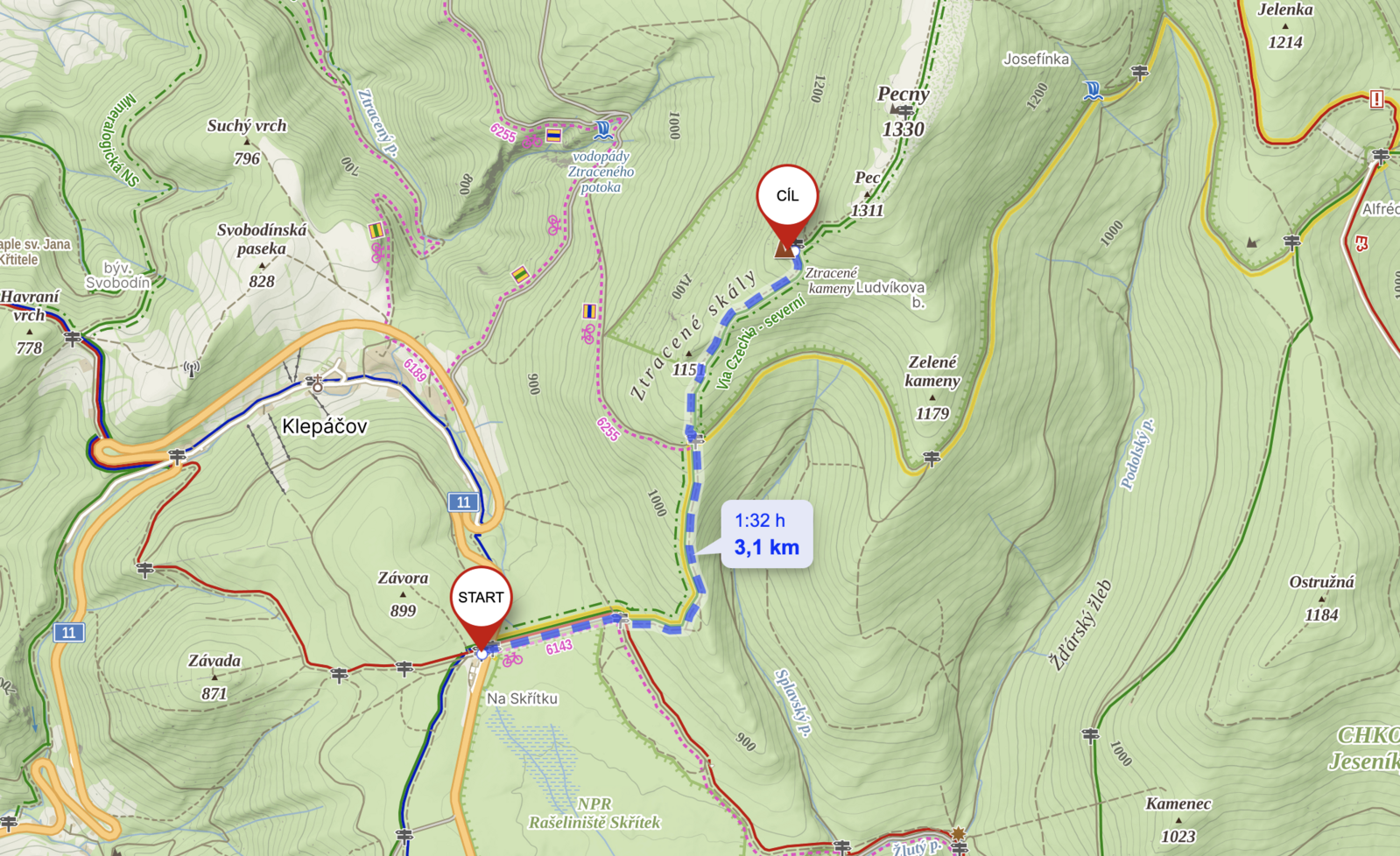
To Ztracené kameny from Skřítek
Motorest Skřítek – Ztracené kameny - Motorest Skřítek
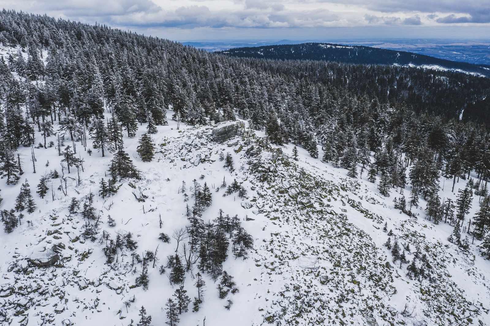
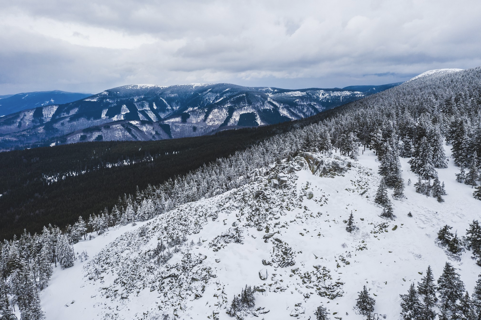
Ztracené kameny are a rock formation on the ridge of Hrubý Jeseník at an altitude of 1250 meters. The peak will provide wonderful views of Hraběšická vrchovina, Šumpersko and Králický Sněžník. The lost stones are the first peak of the ridge route in the direction of Jelení studánka and Peter's stones to the Ovčárna convalescent home.
A legend is related to the stone sea, according to which the devil spilled these stones from his boots while chasing a local farmer.
DESCRIPTION OF THE ROUTE
By car or bus, we will get to the Skřítek motor station. From the Skřítek motor station, cross the main road and follow the green marked path (concurrent with the red and yellow signs) to the Nad Skřítkem information point. On the right side of the road is the national nature reserve Rašeliniště na Skřítku with rich peat flora - it is not open to the public. We continue through the forest, first along the path and then along the path in parallel with the yellow sign to the information point Pod Ztracenými kameny (1100 m) and then only on the green marked path to Ztracené kameny (1250 m). From here there is a beautiful view of the valley of the river Merty and the Sobotín region.
TIPS
A more challenging, very popular route leads from Skřítek along the green sign in the direction of Ztracené kameny – Pecný – Jelení studánka - former tourist hut Alfrédka (yellow parallel to red) – Pod Josefínkou (yellow ) – Pod zelenými kameny – Pod Ztracenými kameny – Nad Skřítkem – Skřítek. The length of this route is 16.6 km, the time required is around 6 hours.
DURATION
4-5 hours
DISTANCE
6 km (there and back)
DIFFICULTY
medium, challenging climb, rocky terrain
SUITABLE FOR KIDS
yes
SUITABLE FOR STROLLER/PROLLER
no
GPS COORDINATES
50.0160767N, 17.1745950E