Praděd
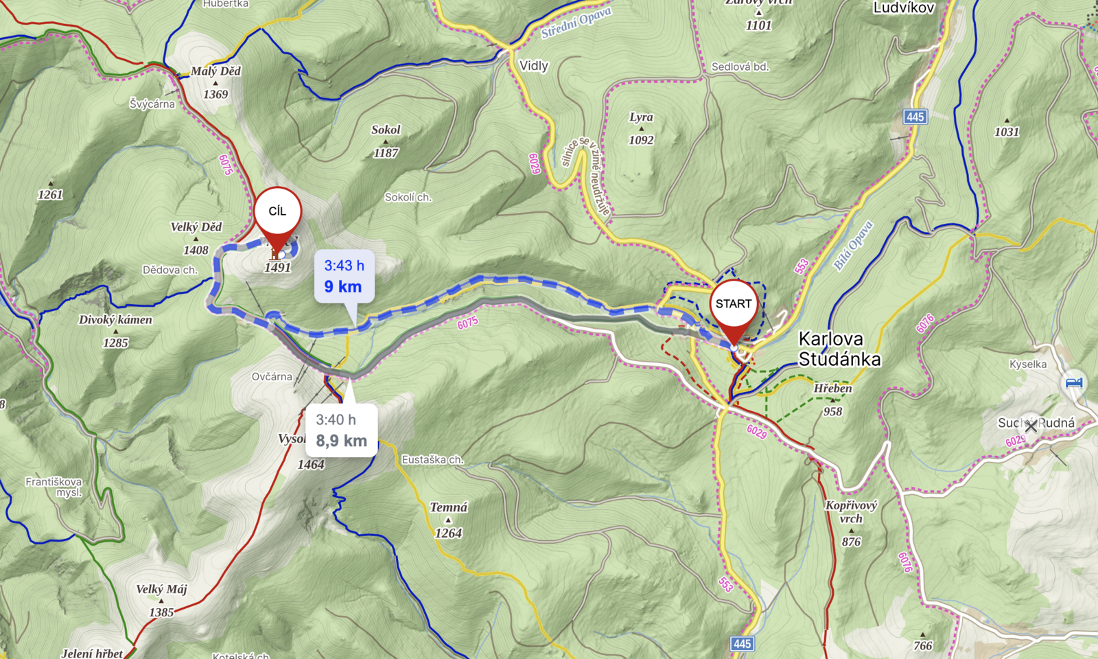
Spa Karlova Studánka – Hvězda – Hotel Ovčárna – Praděd – Chata Barborka – Bílá Opava waterfalls
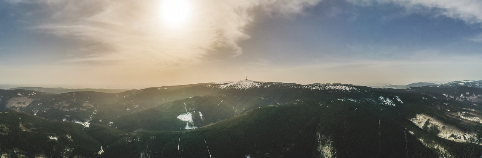
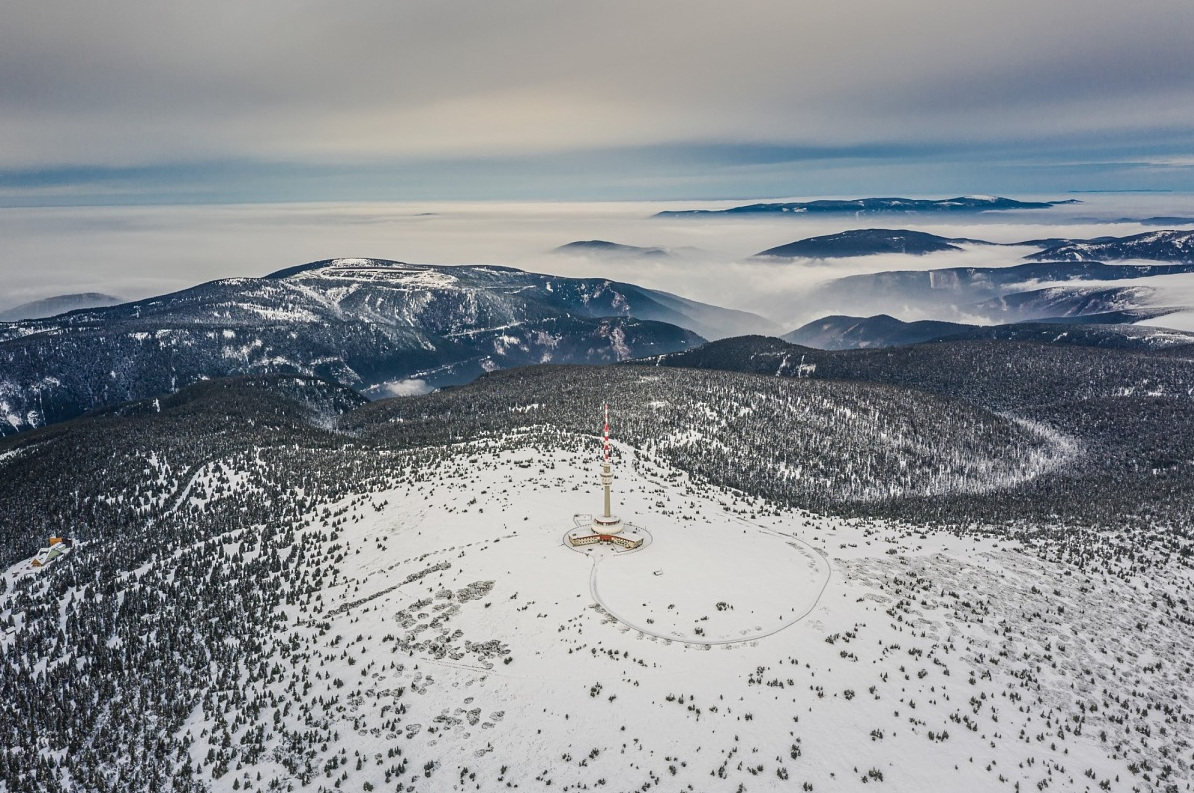
The highest mountain of Moravia and the highest peak of the Hrubý and Nízký Jeseník is Praděd (1 492 m). On its summit there is a television transmitter with a restaurant and a lookout tower.
Praděd is accessible from several directions. The asphalt road from Karlova Studánka leads to the top via the Hvězda saddle and the Ovčárna hut, which is also copied by the green tourist sign (9 km). Touristically, Praděd is also accessible via the main red-marked ridge from Červenohorské sedlo (about 10 km). The steepest ascent leads along the blue-marked path from Kouty nad Desnou past the lower reservoir of the Dlouhé stráně pumped water power plant (about 14 km with an elevation gain of 800 m). Other options are the route from the northeast from the Vidly saddle or from the southwest from the Skřítek saddle.
DESCRIPTION OF THE ROUTE
Eight kilometres and approximately 750 metres of altitude await those who set off from Karlova Studánka to Praděd through the valley of the Bílá Opava. However, the journey through the romantic canyon along the rocky banks of the mountain gorge with many rapids, cascades and several waterfalls is suitable only for experienced hikers. From the crossroads Pod Ovčárnou, the yellow trail turns to the mountain hotel, but you can continue to the Barborka hut and join the asphalt road leading to Praděd about a kilometre above Ovčárna.
Of course, you can also choose the route along the Bílá Opava for the return journey, where you will go all the way downhill from Praděd to Karlova Studánka; conversely, those who have climbed Praděd on foot can return by bus via Hvězda.
DISTANCE
8 km
DURATION
3 hours 20 minutes
DIFFICULTY
hard
SUITABLE FOR CHILDREN
no
SUITABLE FOR STROLLER/PROLLER
no
GPS COORDINATES
50.0772728N, 17.2945786E